DAY 1 – SANTIAGO, CHILE
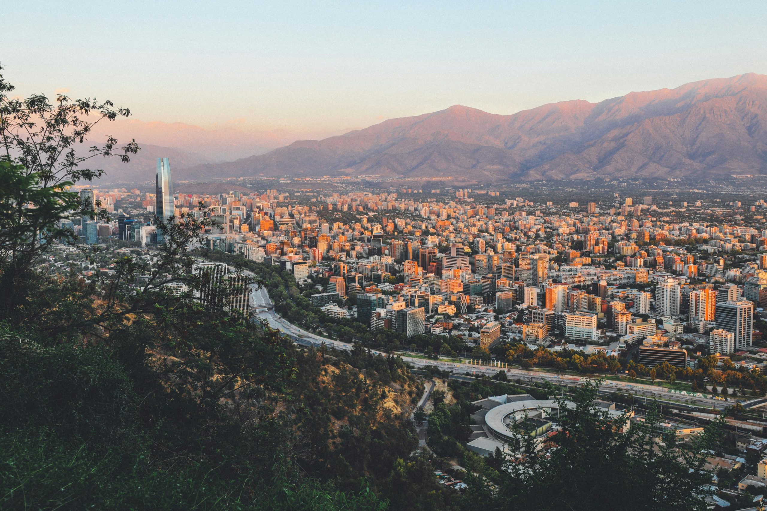
This large, modern port serves Chile’s capital, Santiago, a city with Spanish colonial charm and a vivacious spirit. Encircled by the Andes and the Coastal Range, Santiago is centered around the Plaza de Armas, with several of the city’s landmarks: the 18th-century Metropolitan Cathedral the Palacio de la Real Audencia from 1808, the City Hall and the National Museum of History.
North of San Antonio lie the picturesque old port and university town of Valparaíso and the colorful seaside resort of Viña del Mar. In between the coast and the capital are valleys filled with some of Chile’s most famous wineries, all inviting you to come and taste.
DAY 2 – DAY AT SEA
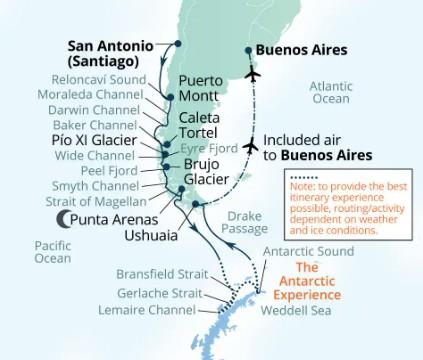
DAY 3 – RELONCAVI SOUND TO POERTO MONTT, CHILE
Reloncaví Sound is a panoramic vista of high volcanoes. To the south, is scenic Moraleda Channel and the entrance to the picturesque Chilean Fjords.
Puerto Montt, in Chile’s Northern Patagonia Los Lagos region is set on the shores of a large bay identified as Reloncavi Sound. To the east looms Mt. Yate, a snowcapped, glaciated stratovolcano, and beyond that the cordillera of the Andes. The sound is punctuated by islands, the three largest being Tengio, Maillén and Huar. Two much larger islands, Puluqiui and Queulín, sprawl across the mouth of the sound, separating it from the Gulf of Ancud.
The point where the Reloncavi Estuary empties into the sound is effectively where the Chilean Central Valley meets the Pacific Ocean. Salmon farms dimple the coves of the sound, and pods of orcas are sometimes seen. Near the sound on shore, Chile’s Alerce Andino National Park protects a vestigial forest of ancient alerce trees, similar to the huge sequoias found in North America.
DAY 4 – SCENIC CRUISING MORALEDA & DARWIN CHANNELS
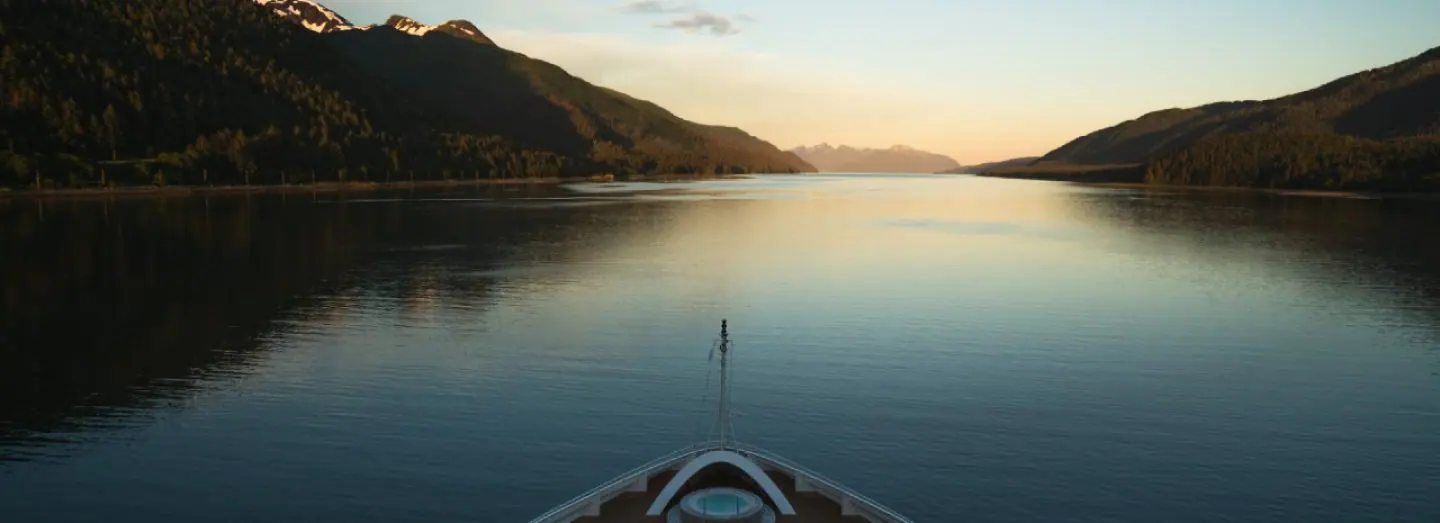
The Moraleda Channel is a protected waterway running along the coast of Chile from the Gulf of Corcovado in the north to the Laguna San Rafael in the south. It separates the myriad mountainous islands of the Chonos Archipelago from the Chilean mainland. Like the Inside Passage on the Pacific coast of North America, the Moraleda Channel is a geological feature. Its course follows the geologic Liguiñe-Ofqui Fault on the eastern side of the islands, which are actually the peaks of the submerged Chilean Coastal Range.
The Darwin Channel cuts through the elongated, mountainous islands of the Chonos Archipelago in Southern Chile, connecting the Pacific Ocean on the west with the Moraleda Channel running along the Chilean mainland. These forested islands, mostly uninhabited, are actually the peaks of the submerged Chilean Coastal Range. Darwin Channel is a westward continuation of the Aysén Fjord, connecting to the Pacific at Isquiliac Island, and opening at its eastern end into Darwin Bay. Being free of navigational hazards, it forms a preferred, scenic pathway for ships navigating in the area.
DAY 5 – BAKER CHANNEL TO CALETA TORTEL, CHILE
The Baker Channel is a large, multi-armed fjord that cuts from Tarn Bay in the Gulf of Penas some 75 miles into the Chilean mainland. It lies roughly halfway between the Northern and Southern Patagonian Ice Fields, and its southern arm culminates at the face of the Jorge Montt Glacier, which flows from the Southern ice field and frequently calves icebergs into the channel. The channel forms the northern boundary of Chile’s vast Bernardo O’Higgins National Park.
On the long Messier Channel between the huge Wellington island and the Chilean mainland, the English Narrows is a natural, eight-mile obstacle consisting of a scattering of islands constricting the passage to a width of as little as 200 yards. It presents no hazard to a skilled navigator under most conditions, but at spring tides the current runs as much as six knots, and wind conditions may also make navigation risky. The narrows transit is a good time to be on deck, to keep an eye out for birds such as diving petrels or steamer ducks, and possibly the small, rare dolphins that are sometimes seen in remote areas like this.
DAY 6 – SCENIC CRUISING EYRE FJORD TO PIO XI GLACIER
Eyre Fjord penetrates the mainland of southern Chile from the Icy Channel about 20 miles to the broad face of the massive Pio XI glacier, also known as the Brüggen Glacier. It is the longest glacier in the Southern Hemisphere outside Antarctica, flowing some 40 miles from the Southern Patagonian Ice Field to the fjord. It is also one of the very few advancing glaciers on earth. The glacier face is located near a large eastern arm of Eyre Fjord called Exmouth Fjord.
At the head of scenic Eyre Fjord is situated the longest glacier in the southern hemisphere outside of Antarctica. The monumental ice-mass of the Brüggen Glacier fills the fjord to a width of 4.5 kilometers (3 miles) and covers an area of 1,265 square kilometers (488 square miles). Colossal ice cliffs rise to a height 75 meters (246’) and are cut by deep-blue crevasses, and free-standing ice pillars known as seracs.
Some 66 kilometers (41 miles) upstream of where it meets the ocean, the Brüggen Glacier merges with the ice of the Southern Patagonian Ice Field. Unlike other glaciers worldwide, it advanced significantly from 1945 to 1976 adding nearly 60 square kilometers (23 square miles) to its toe. Located deep within the boundaries of Bernardo O’Higgins National Park, it was named after the German-Chilean geologist Juan Brüggen Messtorff. Bernardo O’Higgins National Park is one of the last refuges for the small Chilean deer known as a huemul and species such as the Andean condor and marine otter may also be found here.
DAY 7 – PEEL FJORD TO BRUJO CLACIER, CHILE
Cutting eastward from the Sarmiento Channel in Southern Chile, this fjord divides into three separate fjords, called Amalia, Asia and Calvo Fjords. Amalia leads to Amalia Glacier, the El Brujo Glacier is in Asia Fjord, and Calvo boasts several small glaciers of its own. The mainland to the east is all part of the huge Torres del Paine National Park. The area is a fascinating geological panorama, and your expedition team members will be available to interpret the sights, as well as identify wildlife spotted while cruising the scenic waterways.
Entering Peel Fjord from the Sarmiento Channel in southern Chile, your ship veers into the branch called Asia Fjord. As you cruise deeper into the fjord, the water’s surface is dappled with floating ‘bergie bits’ of ice, and occasional larger growlers. Meanwhile the steep slopes on either side are tinseled with lacy waterfalls flowing from the snow-frosted peaks above. Ahead, two ochre slopes cradle a glowing blue-white face of cracked and fissured ice two kilometers across and hundreds of feet high, spilling with geologic slowness from the South Patagonian Ice Field far up the valley. Occasionally a huge shard of ice falls silently into the sea, followed seconds later by the delayed sound of its crack and thunder. You are in the midst of Chile’s Bernardo O’Higgins National Park, the nation’s largest protected region.
DAY 8 & 9 – STRAIT OF MAGELLAN TO PUNTA ARENAS, CHILE
Punta Arenas is the most important port and commercial center for the immense Patagonian agricultural area of Chile. The economy revolves around the sheep raised on the expansive pampas. Located on the Strait of Magellan separating the mainland from the island of Tierra del Fuego, the city proclaims itself the southernmost city in the world. Its colonial history may be explored in the splendid Plaza de Armas, in the magnificent tombs of the Pioneer Cemetery and the opulent Braun-Menendez Mansion.
The heritage of Ferdinand Magellan’s exploration can be recaptured at the Nao Victoria ship museum. Fort Bulnes national monument memorializes the earliest colonial period, while the offshore Los Pinguinos Natural Monument preserves the thriving seabird and sea lion colonies around Magdalena Island. This is also the port from which a full-day flight excursion takes visitors to the majestic peaks and picturesque lakes and wildlife of the Torres del Paine National Park.
DAY 10 & 11 – AT SEA
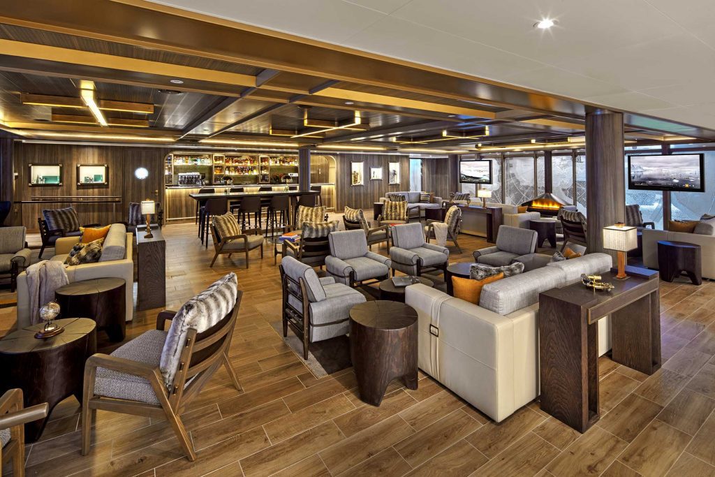
Unwind with a spa treatment or enjoy leisure activities onboard, from cafes to the card room.
DAY 12 to 16 – ANTARCTIC EXPERIENCE
Depending on weather, ice conditions and reported wildlife distribution during your voyage, your captain and expedition team will program days of discovery and adventure for you in Antarctica.
DAY 17 & 18 – AT SEA
Spend a relaxing day at sea, enjoying the ship’s amenities, from dining options to public spaces.
DAY 19 – USHUAIA, ARGENTINA & FLIGHT TO BUENOS AIRES
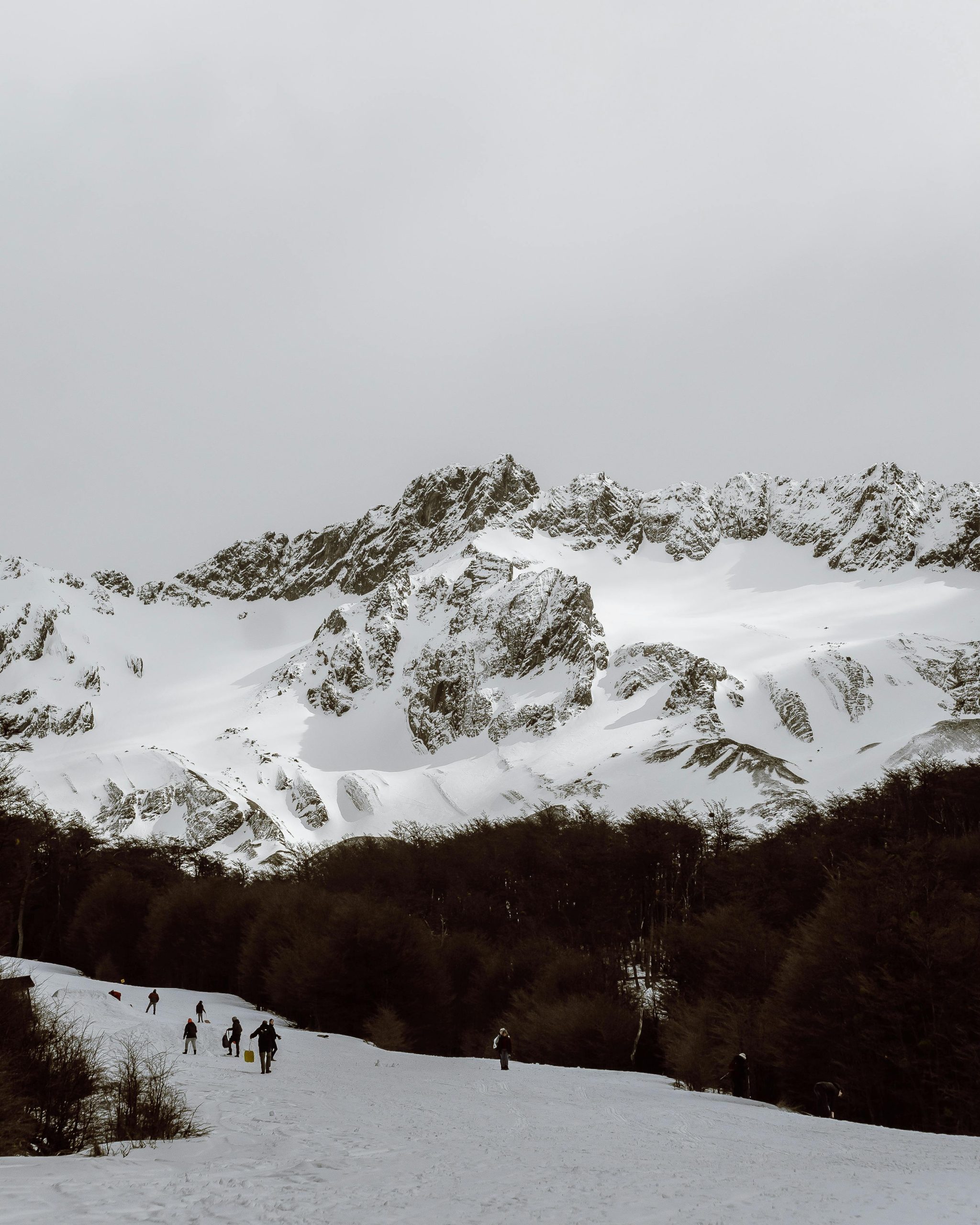
Once deemed too harsh for European settlement, Ushuaia’s rugged beauty was the realm of its native inhabitants – the Yahgan People. Today, it holds the distinctive title of being the southernmost city on Earth, often referred to as ‘the end of the world.’ Situated along the banks of the Beagle Channel, Ushuaia unveils itself like an artist’s masterpiece. A mosaic of vibrant houses adds a splash of color against the dramatic backdrop of snow-capped mountains. Dominating this breathtaking panorama is Monte Olivia, its jagged peaks soaring 4,530 feet above the landscape.
Ezeiza International Airport, the airport for Buenos Aires. Referred to as the ‘Paris of South America’, Buenos Aires is considered as one of the most livable cities in South America. Although the bustling capital city has just under 3,000,000 inhabitants and a population density of 13,680 inhabitants per square kilometer (34,800 per square mile), it was rated in 2018 as one of the top cities on the continent for its ‘quality of life’.

